- Details
- Parent Category: Въездной туризм
- Published on Wednesday, 03 March 2010 10:28
- Hits: 34156
Tour. Agency SEASON TRAVEL KZ offers:
Hike to Lake Makpal
PASSPORT
Hiking trails (ROUTE)
1. Designation of protected areas - Sairam-Ugam SSPE.
2. The name of the trail (trail) - Lake Makpal.
3. Classification path (route):
1) by type of movement: walking, water, skiing, cycling, equestrian, automobile, motorcycle, horse-drawn, combined;
2) at the time of action: year-round, seasonal;
3) in the form of organization: group;
4 (the name of the main geographical areas) range Ugamsky - cordon Ugham - p. Ugam - Gorge Diermenbastau - per. Passing (2790m) - oz. Makpal.
5. 45 km length of the trail (including radial output and return).
6. Terms functioning path (route) July - September.
7. The maximum number of people in the group, what has caused the restriction (with a capacity of observation platform, psihokomfortnym limit rules recreational pressure, etc.). Limit tour groups a week or a month (recreational load). No more than one group to 14 people. a week with only two Camping grounds.
8. Permitted recreational loads for the various periods in the tour season (if at any time in the season to reduce the load, for example, give peace of mind when birds hatching chicks).
Reducing the load up to 7 people. per week should be carried out in September, because in this period there is an active migration of wild animals birds.
9. Ability to complete the trail without a guide. The group released the route only with a guide-breeder.
As the trail is marked. What is the need to have of clothing (such as special clothing, if the trail is planned to visit the cave) and shoes (like boots, if there is a risk of wetlands with wet feet, that is, without a special wooden flooring).
The trail is marked direction indicators and signs location Camping grounds.
10. Special rules of conduct on the trail (in addition to the general rules of behavior in this protected area, for example, do not go off the path, do not approach the edge of the cliff, observe other precautions).
Do not go off the trail. Sophisticated, rocky areas must take place on foot, leading the horse on a fairly long leash.
11. Security measures.
High grass requires increased caution in the use of fire. Build a fire in specially equipped centers.
12. The scheme trail (trail) (permitted insert printing of maps and charts published by the scale of at least 1:200,000 with marked trails.
14. Legend: path (route), place of shelter, replacement options, places nights, shelters. Points of contact (specify type of communication) Communication conductor with a cordon Ugamsky carried out on a mobile radios on schedule. The nearest medical aid medical aid is in the village. Pervomaevka 30 km from the cordon.
15. A brief description (description) path (route).
16. Brief description of the inspection along the path (route) and observation (review) sites.
The main facilities are included in the itinerary:
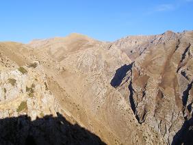
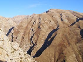
Oz. Makpal is located at an altitude of 2290 m asl. y. m, 15 km from the section at the top of Ugham deep gorge Makpalsay on the northern slope of the ridge Ugamsky. The route starts from the bridge over the river. Ugam in the south and passes through the picturesque countryside among apple orchards and uryukovyh, hawthorn and juniper woodlands. After 2.5 hours, the path turns to the east. We turn to the tract Diermenbastau and stay at a spring camp for lunch. The route runs along the bottom of the gorge right Diermenbastau to the south. The slopes of ravines covered with thickets of wild rose, growing apple Sievers, Alchan and barberry. The upper part of the spurs and dzhaylyau are mixed grass meadows. Often found Kaufman tulip variety of colors and shades. At an altitude of 2,000 m in the upper reaches of a spectacular panorama of ridges and Karzhantau Ugamsky and majestic river valley Ugham. This route takes in the alpine meadows with a few groups of dwarf juniper Turkestan. The trail crosses often Alay Mountains (lizard) - the most dexterous hunter of insects. The route runs along the top of the gorge Azarteke, which turns sharply to the east and ends with a jumper - Passing the pass (2790m). Gentle descent to the lake and protracted. Time 6 hours.
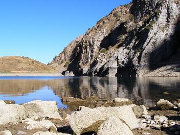
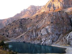
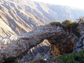
Oz. Makpal is in a deep bowl. The eastern part of the lake is bounded by high cliffs, the western part rests on a strong jumper, in the southern part of the creek flows, and the western part - is a vast alpine meadow with juniper woodland. The lake area is about 2000 square meters. m, depth approx. 15 m emerald water - blue, the water temperature in July and August is 18 degrees to the small, beach areas. Middle rocky area at an altitude of 50 meters distracting spring. Following the shore there is a cave in the rock.
Here unusually strongly felt the harmony of nature - the golden eagle soars in the air, on the gentle slopes of the southern snowcocks shout, and high grassy areas under rocks graceful grazing mountain goats.
The next day, radial access to the lake. Konzhyk glycol, which is located in 4 km down the gorge. Konzhyk small lake (150 m) - is a real oaziz surrounded by fragments of rocks covering the bottom of the gorge along its entire length. Succulent herbs, rhubarb Maksimovic, Pskem onions, wild apple, and barberry Alchan attract Tan Shan bear.
On the third day return to claim Ugham on the rise.
17. Brief description of the difficult parts of the trail (route). With the passage of the site to the lake. Konzhykkol need to move, focusing on the "tours", as stone scree mobile.
18. Possible natural disasters and actions of the group as they occur. In the case of thunderstorms, stop, put up a tent in a low spot and wait it out.
19. Recommendations for the text of a leaflet to the voucher.
Makes recommendations regarding hiking equipment, clothes, shoes, behavior, etc.
Be sure to have a hat for protection from the sun, rain jacket, first aid kit and spare shoes, be careful when passing the talus and strictly follow the instructions of the guide-breeder on the route.
20. Landscaping path (route) marking.
Signposted.
Parking areas, shelters, landscaping path (route) Camping grounds are equipped with pockets.
 |
 |
 |
Ladies and gentlemen, Season Travel Kz organizes a trip to the South Kazakhstan region with visits to ancient cities such as Turkestan and Sairam, Sauran, Otrar and introduce you to the historical and architectural monuments of the Great Silk Road.


