- Details
- Parent Category: Въездной туризм
- Published on Wednesday, 03 March 2010 12:00
- Hits: 29896
Tour. Agency SEASON TRAVEL KZ offers to visit
creek Boztorgai
PASSPORT
Hiking trails (ROUTE)
1. Designation of protected areas - Sairam-Ugam SSPE.
2. The name of the trail (route) - "Brook Boztorgai" 12 km route is nature trail (route number 8).
3. Classification path (route):
1) by type of movement: walking, water, ski, bike, horse, automobile, motorcycle, horse-drawn, combined;
2) at the time of action: year-round, seasonal;
3) in the form of organization: individual and group;
4 (the name of the main geographical areas) Mountain Boraldaytau - cordon Kokbulak - Boztorgai creek.
5. 18 km length of the trail (including the return on the same path), duration 8:00 55minut (including stops).
6. Terms functioning path (route) April - October.
7. The maximum number of people in the group, what has caused the restriction (with a capacity of observation platform, psihokomfortnym limit rules recreational pressure, etc.). Limit tour groups a week or a month (recreational load). Not more than 2 groups of 10 people. a week with only three Camping grounds.
8. Permitted recreational loads for the various periods in the tour season (if at any time in the season to reduce the load, for example, give peace of mind when birds hatching chicks).
Reducing the load up to 10 people. per week should be carried out in April, as in this period the birth of the offspring at the argali.
9. Ability to complete the trail without a guide. As the trail is marked. What is the need to have of clothing (such as special clothing, if the trail is planned to visit the cave) and shoes (like boots, if there is a risk of wetlands with wet feet, that is, without a special wooden flooring). The trail is marked signs and nameplates. Go through the stream carried by bridges. No special equipment is required.
10. Special rules of conduct on the trail (in addition to the general rules of behavior in this protected area, for example, do not go off the path, do not approach the edge of the cliff, observe other precautions).
Do not go off the trail.
11. Security measures.
High grass requires increased caution in the use of fire. Build a fire in specially equipped centers.
12. The scheme trail (trail) (permitted insert printing of maps and charts published by the scale of at least 1:200,000 with marked trails.
13. Legend: path (route), place of shelter, replacement options, places nights, shelters.
14. A brief description (description) path (route).
15. Brief description of the inspection along the path (route) and observation (review) sites.
The main facilities are included in the itinerary:
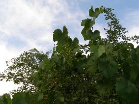
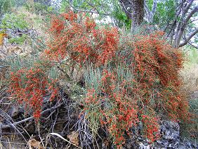
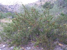
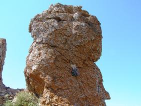
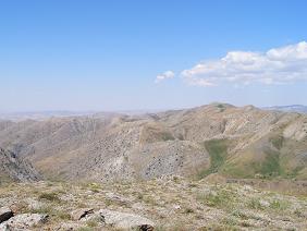
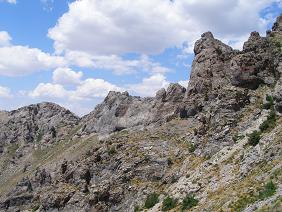
The route runs in a south-eastern part of the ridge to the village Boraldaytau.Proezd Psteli Tyulkubas area (71km), then 4 km down a country road on the right hand side of the river. Kokbulak to cordon National Park. The route starts from the cordon along the creek Boztorgai in the north-east. The ecosystem of the gorge Boztorgai unique. Small height, high average temperatures, fertile mountain-brown soil and sufficient moisture, create favorable conditions for the growth of a large number of trees, shrubs and herbs, including endemic. In the beginning the trail goes through the nut and apricot orchard interspersed with dzhida and cherry. Moving along the trail along the creek, whose waters a few times then appear on the surface, then disappear and flow underground. The banks of the creek thickly overgrown with willow rock, ash and maple Semenov. At 2 km from the cordon grows a unique look - wild grapes. The slopes of the gorge covered with hawthorn, and on both sides of the creek rather thickly growing pistachio with frequent patches of Alchi, apple and pear Regelya.Tropa Sievers is then on the right, then the left side of the bed and 1.5 hours leads to a picturesque place where from under the rocks knocked cold spring Karabastau. Stopping for a rest. Above route increases the number of the frame of the Caucasus, there ephedra bush with bright orange shishkoyagody, krasnoplodnoy cherry and rose hips. Half an hour later the main canyon turns east. Hence it is clearly visible pass leading to the village Alexeevka Zhambyl region. At the top of the slopes - large areas of rocks with green dots junipers - the habitat of argali Karatau and Elika. The creek go track porcupine quills and badger. After 1 hour and 15 minutes to go to a place out of the stream on the surface opposite the sai Zhamanbastau. Here, stop for lunch. After lunch - towards burrows porcupine quills and observation platforms argali. Return the same way.
16. Brief description of the difficult parts of the trail (route). In May-July increased the water level in the river could complicate the crossing.
17. Possible natural disasters and actions of the group as they occur.
18. Recommendations for the text of a leaflet to the voucher. Makes recommendations regarding hiking equipment, clothes, shoes, behavior, etc. It is recommended to wear a hat for protection from the sun. In April and May could be mites, so you should regularly inspect the clothes and the body.
19. Landscaping path (route). Marking. Signposted.
Parking areas, shelters, landscaping path (route) Camping grounds are equipped centers, waste bins and toilets.
Ladies and gentlemen, Season Travel Kz organizes a trip to the South Kazakhstan region with visits to ancient cities such as Turkestan and Sairam, Sauran, Otrar and introduce you to the historical and architectural monuments of the Great Silk Road.


