- Details
- Parent Category: Въездной туризм
- Published on Wednesday, 03 March 2010 11:39
- Hits: 34817
Tour. Agency SEASON TRAVEL KZ offers a route:
Saryaygyr - Lake Susingen - Campsite "Southern"
PASSPORT
Hiking trails (ROUTE)
1. Designation of protected areas - Sairam-Ugam SSPE.
2. The name of the trail (trail) - p. Saryaygyr - Lake Susingen - Campsite "South."
3. Classification path (route):
1) by type of movement: walking, water, ski, bike, horse, automobile, motorcycle, horse-drawn, combined;
2) at the time of action: year-round, seasonal;
3) in the form of organization: individual and group;
4 (the name of the main geographical areas) cordon Saryaygyr - p. Saryaygyr - ur. Mynzhilki - per. Tkenek (3230 m) - p. Akburhan - ur. Shagyrtas - oz. Susingen - per. Ulyzhurt (2640m) - per. Kshizhurt - ur. Kyrykkyz - p. Badam - cordon Badam
5. The length of the path length of 72 km 6 days.
6. Terms functioning path (route) April - October
7. The maximum number of people in the group, what has caused the restriction (with a capacity of observation platform, psihokomfortnym limit rules recreational pressure, etc.). Limit tour groups a week or a month (recreational load). Not more than 2 groups of 15 people. per week, which is the most appropriate psihokomfortnym limit.
8. Permitted recreational loads for the various periods in the tour season (if at any time in the season to reduce the load, for example, give peace of mind when birds hatching chicks).
Reducing the load to 1 group (10 people). Need to spend a week in August, as this period is the most active in feeding marmots marmot.
9. Ability to complete the trail without a guide. The group released the route must be accompanied by a tourist guide or guide-breeder. This is due to the fact that the area Tracts Mynzhilki trail passes close to the habitat conservation area "Red" marmot marmot. As the trail is marked. What is the need to have of clothing (such as special clothing, if the trail is planned to visit the cave) and shoes (like boots, if there is a risk of wetlands with wet feet, that is, without a special wooden flooring). You must have hiking shoes or boots, as in the passes may be snow.
10. Special rules of conduct on the trail (in addition to the general rules of behavior in this protected area, for example, do not go off the path, do not approach the edge of the cliff, observe other precautions).
Strictly adhere to the trails and do not frighten the animals.
11. Security measures. Build a fire in specially equipped centers.
12. The scheme trail (trail) (permitted insert printing of maps and charts published by the scale of at least 1:200,000 with marked trails.
13. Legend: path (route), place of shelter, replacement options, places nights, shelters.
14. A brief description (description) path (route).
15. Brief description of the inspection along the path (route) and observation (review) sites.
The main facilities are included in the itinerary:
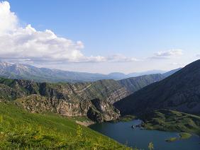
The entire route is in the range Karzhantau.
1 day
Directions to the s. Kaskasu Tolebi district, followed by 12 miles on a dirt road to the confluence of the rivers and Saryaygyr Sayramsu. Cordon of the National Park movement (1 chas40min) runs along the river Saryaygyr to the confluence of the rivers Ular. On the right bank Saryaygyra is the old orchard - a popular place for feeding the bears in the autumn.
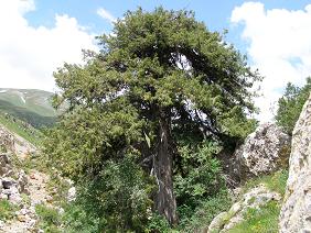
Next, the trail goes along the left bank of the river. Dense thickets of juniper and brush, several spring mud offsets hinder movement. Where the trail passes by two rocky snuggling, you need to dismount and lead the horses. After 2h. 20m. go to the fields, overgrown of dwarf juniper. The movement continues to alpine meadows. A lot of marmots marmot, a group of graceful mountain goats on the rocky shelves pleasing to the eye and enliven the course. After 45 minutes, the gorge turns abruptly to the right. After the turn pass on the right bank of the more gentle and go west on a well marked trail nepugannyh a deafening whistling marmots. Within an hour moving in a westerly direction to the turn to pass Junior and stop for the night.
Day 2 The path to the pass Tkenek begins in the early morning crossing of the river Saryaygyr and a sharp rise in the creek, which flows into the river from the north-west. After 45 minutes, go out on a large alpine meadow at the top of the stream. In the south-west is seen pyramidal rock out. The motion to pass Tkenek should be implemented in the south-west, skirting rocky pyramid on the left. The rise from the place of lodging to the pass takes about 2 hours. From the pass to the south panorama Ugamsky ridge, and in the north-west is clearly visible dark Baybishe peak (2891m). The descent from the pass runs along the right side of the river Tkenek about 3 km. Then, at the bend of the river to turn sharply to the right on the north, to pass a small spur, go down to the creek sai Akburhan and move along the river in the north-west before turning left. From the north to the river empties into a small spring. We go up to the left of the spring on the trail, turn left and go down the right side of sai Korymsay in the same north-westerly direction. Korymsay smoothly into the gorge Shagyrtas. The first occurrence of juniper on the slopes stop for the night. The descent from the pass takes 3 hours and 20 minutes.
Day 3
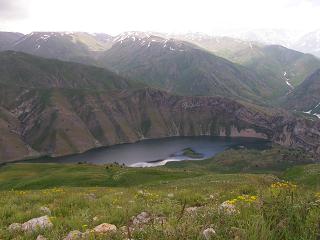
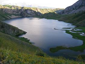
Continue on the left bank of the river. Shagyrtas the well-being within a path that turns to the west at the confluence of the rivers and Shagyrtas Togutba. 2.5 hours after the start of the movement come to the place where the south-east flows into a small stream. The river itself is surprisingly Aygyrzhikkan shallower (apparently, most of the water goes into the underground tunnels and is, in fact, the river Aygyrzhikkan a 2-km below the lake. Susingen. Way to the lake begins with the crossing to the right bank and the movement along the river above the river about 1 km, then the trail turns sharply to the north-west and up to the saddle in the middle of the spur. saddle with a good trail goes up the ridge and the top of the left sai before reaching the summit plateau, which offers a beautiful view of the lake Susingen , Ugamsky and Karzhantausky ranges. Descending the ridge to the right of the lake. ferried across the river, which flows into the lake and along the right bank reach the junipers, where we stop for the night.
Day 4
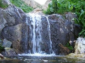
Rest. Fishing (in the lake is speckled trout). Radial hike to the creek cascades on the east side of the lake.
Day 5
The way up Ulyzhurt starts to the right of juniper in the north-west on a good path. After 3 hours, leaving the left - and Maylysay Kazanshukur and right - Baybishe, go out to the pass Ulyzhurt and stop for a rest near a stream. Next we move to the west along the upper right trail, leaving Kshizhurt mountain (2858m) on the right. The trail gradually descends and 1.5 hours displays in the upper reaches of Badam. After 3.5 hours, come to the tract Kyrykkyz. Here stop for the night at the well.
Day 6
The next day, commit radial access to the mountains, remnants of the Kyrykkyz
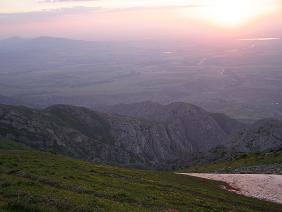
Descent to the camp "South" takes place on the top of the left slope of the valley of the river Badam and takes about 2.5 hours.
16. Brief description of the difficult parts of the trail (route). When climbing to the pass Tkenek possible snow. Details please choose the flat areas and move to the next track. With the passage of the route to the cave with petroglyphs must be borne in mind that in the event of high water level in the river is necessary to move in the middle of the right side of the slope and begin to walk down just in front of the cave.
17. Possible natural disasters and actions of the group as they occur. In the case of thunderstorms, stop, put up a tent in a low spot and wait it out.
18. Recommendations for the text of a leaflet to the voucher. Makes recommendations regarding hiking equipment, clothes, shoes, behavior, etc. It is recommended to wear a hat for protection from the sun, have a rain jacket, spare shoes and a first aid kit, be careful when passing the talus and strictly follow the instructions of the guide-breeder on the route.
19. Landscaping path (route). Marking. Signposted. Parking areas, shelters, landscaping path (route) Camping grounds are equipped with pockets.
Ladies and gentlemen, Season Travel Kz organizes a trip to the South Kazakhstan region with visits to ancient cities such as Turkestan and Sairam, Sauran, Otrar and introduce you to the historical and architectural monuments of the Great Silk Road.


