- Details
- Parent Category: Въездной туризм
- Published on Wednesday, 03 March 2010 12:14
- Hits: 28036
Tour. Agency SEASON TRAVEL KZ offers you conquer
Peak Vladislav
PASSPORT
Hiking trails (ROUTE)
1. Designation of protected areas - Sairam-Ugam SSPE.
2. The name of the trail (trail) - Peak Vladislav.
3. Classification path (route):
1) by type of movement: walking (climbing), water, ski, bike, horse, automobile, motorcycle, horse-drawn, combined;
2) at the time of action: year-round, seasonal;
3) in the form of organization: individual and group;
4 (the name of the main geographical areas) Camping STF "Altex" - p. Sayramsu - p. Kapzhaylyau (gorge "Wild climbers") - per.Snezhny (3350M) - Vladislav peak (3632m).
5. 30 km length of the trail (including return trip).
6. Terms functioning path (route) July - September.
7. The maximum number of people in the group, what has caused the restriction (with a capacity of observation platform, psihokomfortnym limit rules recreational pressure, etc.). Limit tour groups a week or a month (recreational load). Not more than 2 groups of 10 people. a week with only 1 Camping grounds.
8. Permitted recreational loads for the various periods in the tour season (if at any time in the season to reduce the load, for example, give peace of mind when birds hatching chicks).
9. Ability to complete the trail without a guide. The group released the route only with a guide. As the trail is marked. What is the need to have of clothing (such as special clothing, if the trail is planned to visit the cave) and shoes (like boots, if there is a risk of wetlands with wet feet, that is, without a special wooden flooring). The trail is marked signs and nameplates. Special equipment - a windbreaker, mountain boots, rope (30m.).
10. Special rules of conduct on the trail (in addition to the general rules of behavior in this protected area, for example, do not go off the path, do not approach the edge of the cliff, observe other precautions). Take care when moving the traverse talus.
11. Security measures. Build a fire in specially equipped centers. Keep your distance when passing "live" talus.
12. The scheme trail (trail) (permitted insert printing of maps and charts published by the scale of at least 1:200,000 with marked trails.
13. Legend: path (route), place of shelter, replacement options, places nights, shelters.
14. A brief description (description) path (route).
15. Brief description of the inspection along the path (route) and observation (review) sites.
The main facilities are included in the itinerary:
The route takes in the central part of the Ugam Range.
The first day.
We leave from Shymkent in the valley to the campsite Sayramsu STF "Altex" (71km). Moving along a good path along the river Sayramsu and 2 hours we reach the river Kapzhaylau - right tributary Sayramsu. Going down to the river, turn left. The movement continues east on the high right bank of the river. Kapzhaylau flowing in the valley Wild climbers. After 1.5 hours long uphill approach to a comparatively large meadow (the so-called "Green Room") next to the water. It set the base camp.
The second day.
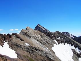
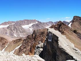
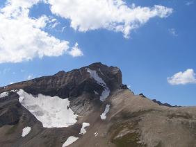
In the early morning light we leave on the route (with a - dry rations, water or a thermos of tea.) About half an hour moving along the right bank, then go to the left bank. After 35 minutes, the trail leads out to the right shoulder of the spur to the peak of Turkestan. Hence it is easily visible saddle of snow and the entire route of approach to it. After 1 hour, we at the pass. Vladislav Peak is visible in the south-east of the saddle and is the pinnacle, the north-eastern side is precipitous, and the south-west is a gentle slope covered with talus with access stone slabs. Go to the top of the move on the south-western slope of the saddle spur, bypassing the stone slabs from the West at the height of the saddle. Scree slope kamneopasen requires a tight group movement and continuous monitoring of the upper part. From the top of a majestic panorama of the mountains of South-West Tien Shan - Chatkalsky Ridge and Mount Chimghan, Pskem and Ugam ranges.
The third day.
Day stay. Walking on Sayramsu (you can visit the top of the lake). Check out the evening of camping STF "Altex".
16. Brief description of the difficult parts of the trail (route). Scree slope kamneopasen requires a tight group movement and continuous monitoring of the upper part.
17. Possible natural disasters and actions of the group as they occur.
18. Recommendations for the text of a leaflet to the voucher. Makes recommendations regarding hiking equipment, clothes, shoes, behavior, etc. It is recommended to wear a hat for protection from the sun, sunglasses and sun block cream. It is recommended to bring a gas burner or a kerosene stove.
19. Landscaping path (route) / Marking. On the trail - indicating the direction and location of Camping grounds. Parking areas, shelters, landscaping path (route) Camping grounds - an observation deck equipped with fireplace.
Ladies and gentlemen, Season Travel Kz organizes a trip to the South Kazakhstan region with visits to ancient cities such as Turkestan and Sairam, Sauran, Otrar and introduce you to the historical and architectural monuments of the Great Silk Road


